Minnesota Pollution Control Agency (MPCA)
Small Communities Planning Grants for
Stormwater, Wastewater, and Community Resilience
Project Goals: Identify locations and causes of localized flooding within the community, assess risk and community vulnerability due to localized flooding, develop potential projects to reduce localized flooding and mitigate the effects of climate change, and estimate the cost of implementation.
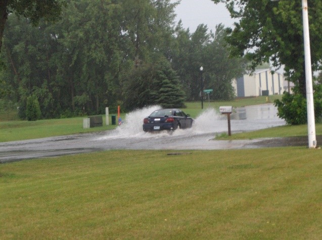
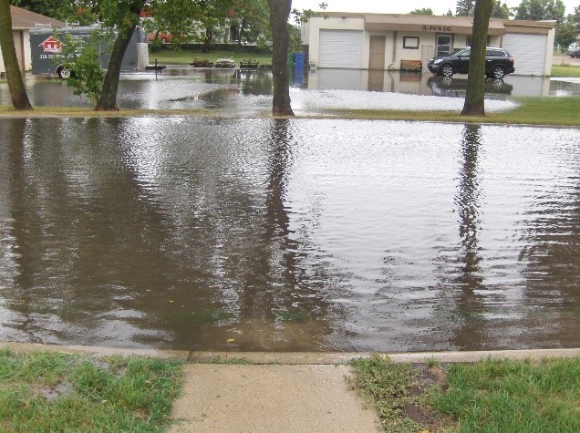
Photos of localized flooding within Hutchinson
What are we doing? Collecting data, preparing a regional (Hutchinson – North) stormwater model, evaluating the model and preparing stormwater imporvement projects. A stormwater management action plan will be developed for the north half of th Hutchinson.
We want your input! Using the community stormwater map, share any information or photos of past flooding and other stormwater related issues that have been observed. Input will help us to create an accurate and useful plan for your neighborhood.
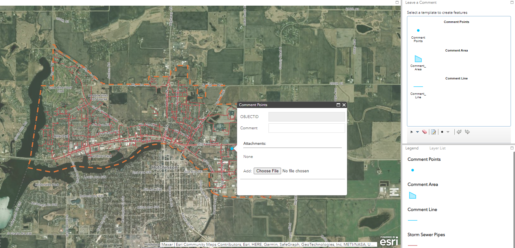
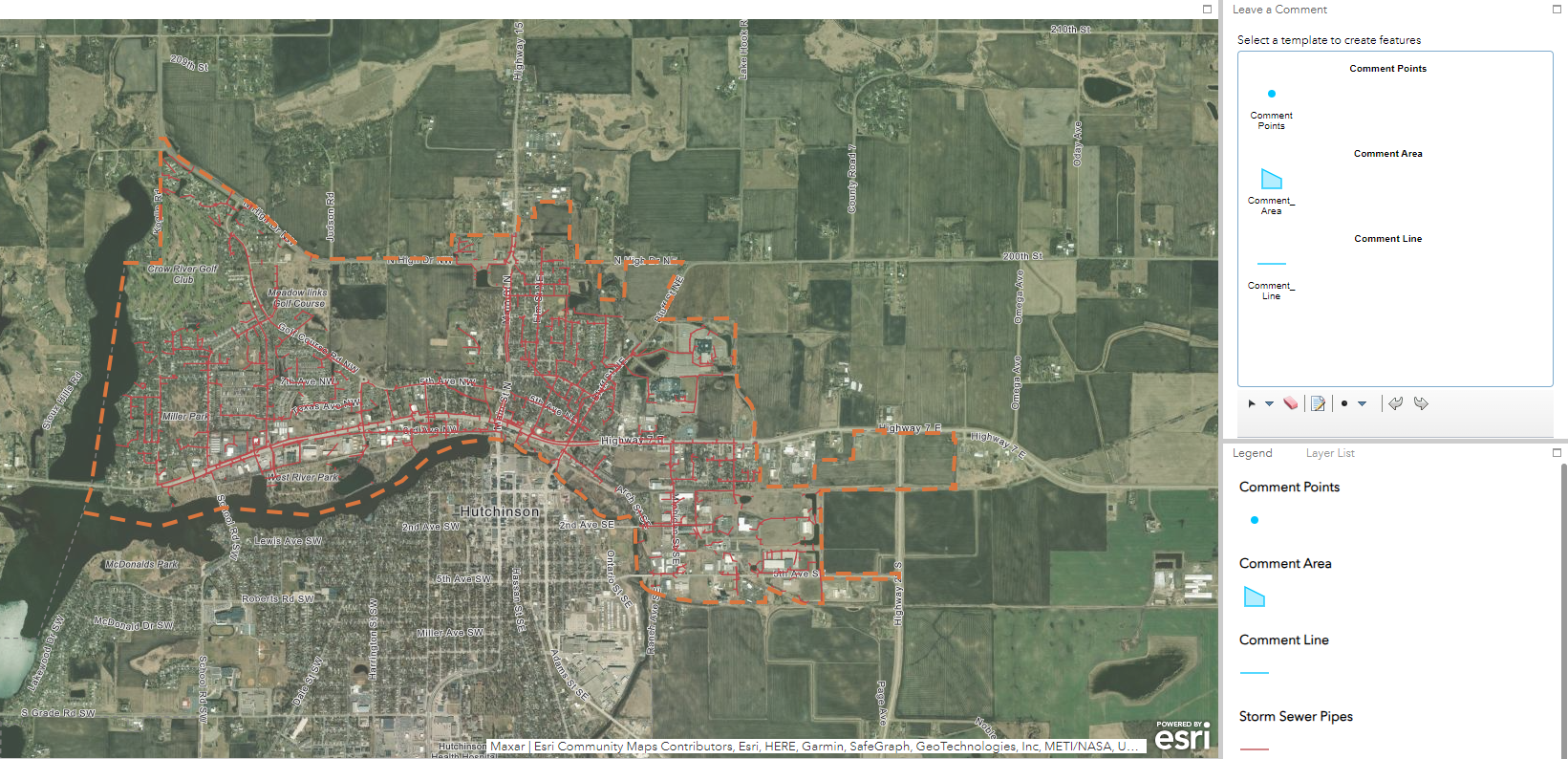
City of Hutchinson Interactive Stormwater Resilience Plan Public Engagement Map (arcgis.com)

City of Hutchinson Stormwater Resilience Plan – Request for Public Input
Select your comment type (point, area or line) in the top right of the screen.
Follow the on-screen popup when you hover over the map.
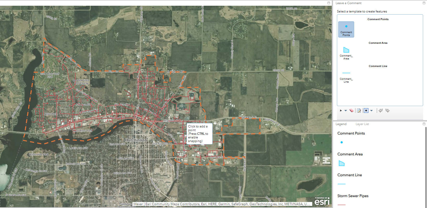
After placing your point, line or areas you will have the opportunity to fill out a comment
(255 characters) and upload an image from your device.